Fire on Navajo Nation brings smoke to San Juan County skies
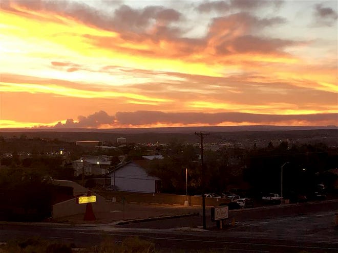
GALLUP — There is the potential for smoke from the Wood Springs Two fire on the Navajo Nation to continue impacting air quality in San Juan County, as it did on June 28, when the sun set amid a pall of smoke.
Firefighters from the Bureau of Indian Affairs Navajo Region Wildland Fire and Aviation Management have been responding to the fire since it was detected three miles east of Wood Springs, Arizona – near Kinlichee Chapter – on June 27, according to the agency.
The blaze has grown to approximately 3,000 acres and is not contained, the agency reported in an update on June 29 on its Facebook page.
According to the update, the Southwest Area Incident Management Team 5 will take over operations on June 30.
The San Juan County Office of Emergency Management on June 28 posted a link to a National Oceanic and Atmospheric Administration (NOAA) website that has a map with fire information, including an illustration of smoke plumes from those fires. It is called the Hazard Mapping System Fire and Smoke Product.
The arrival of that smoke plume led the San Juan County Fire Department to repost the OEM link on its Facebook page, noting, "There is quite a bit of smoke impacting our area tonight - It is coming from the Ganado area."
By 3:40 p.m. on June 29 the smoke plume had reached the Southern Ute Reservation in Colorado, according to a tracking map provided by https://fire.airnow.gov/.
Blaze was sparked by lightning
Residents of the fire zone are encouraged to avoid the area due to hazardous terrain and fire spread, and to keep firefighters safe from potential transmission of the novel coronavirus, the agency stated in the June 29 update.
A press release from Navajo Nation Office of the President and Vice President states that the fire was caused by lightning on June 27.
Road closures are in place for Navajo Route 7 from Sawmill to the Chinle and Wood Springs area and Navajo Route 26 between Nazlini and Sawmill, according to the release.
Rangers are evacuating residents who are in immediate danger and officials are setting up an incident command center at the Ganado Pavilion in Burnside, the release states.

Tribal President Jonathan Nez and Vice President Myron Lizer were briefed about the fire by BIA Navajo Region Director Bartholomew Stevens and BIA Regional Fire Management Officer Dale Glenmore on June 28.
"All residents in the area must be very cautious and we ask that everyone cooperate with the emergency responders, especially if you are asked to evacuate from your residence," Nez said in the release from his office.
He added the tribal government is working with the BIA and chapter governments to provide relief aid and shelter for evacuated residents.
"We must also remain diligent and mindful of the risks posed by COVID-19 as we address this wildfire. Please continue to pray for our Nation and our first responders," Nez said.
Noel Lyn Smith covers the Navajo Nation for The Daily Times. She can be reached at 505-564-4636 or by email at nsmith@daily-times.com.
Support local journalism with a digital subscription to The Daily Times.