Get to know the Butterfield Overland Trail, which cut through southwest New Mexico
This year marks the 50th anniversary of the National Trails System Act. This landmark legislation was signed Oct. 2, 1968, and established the framework for a system of national trails, including scenic and recreation trails. Legislation establishing National Historic Trails was later enacted in 1978. Both acts provide for a process to study and designate future trails like the Butterfield Overland Trail.
Between 1857 and 1861, the Butterfield Overland Trail ran from St. Louis to San Francisco. It was an important transportation corridor for the western migration and settlement of our country, and the beginning of an overland mail delivery system.
In New Mexico, the Butterfield Trail ran east and west across southern New Mexico from El Paso to the Doubtful Canyon station north of Steins, New Mexico and then into Arizona. During a four-year period, the Butterfield stagecoach made stops at Fort Fillmore, Mesilla, Picacho, the Rough and Ready Mountains, Cooke’s Springs, Mimbres, Mexican Springs and Stein’s Peak in route to the west coast.
More:Prehistoric Trackways a treasure trove of unique resources
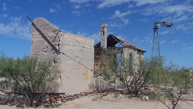
As described in the Bureau of Land Management’s Mimbres Resource Management Plan, the stagecoach stations made of adobe and rock masonry were built at watering points along the trail. In March 1861, the U.S. Government ordered closure of the line in response to Texas' secession from the Union.
The Butterfield Trail and associated stagecoach station localities are considered to have significant regional, historical and archaeological significance. The remains of the trail and stations are fragile and considered non-renewable cultural resources, which are deserving of preservation, research, and interpretation for the general public.
Today, the trail segments that remain are not as distinct as before. However, the efforts to examine the Butterfield Trail’s significance to the American trail system is ongoing.

On March 30, 2009, Congressional legislation was enacted directing the National Park Service to conduct a study of the Butterfield Trail. The NPS, in coordination with other land managers, like the BLM and Butterfield Trail communities, conducted meetings and developed a special resource study/environmental assessment and made a recommendation to the National Park System Advisory Board on the trail’s national significance. Ultimately, Congress will make the final decision on whether to add the Butterfield Overland Trail to the National Trails System or pursue a different form of commemoration.
More:BLM 50th anniversary highlights rivers and trails
In southern New Mexico, the Butterfield Trail crosses federal, state and private lands. Some of the segments on BLM-managed public land include the Robledo Mountains, Cooke’s Peak and the southern portion of the Lordsburg Playa. While these segments are not developed for hiking, the history is still there and the public travelling from St. Louis to San Francisco on Interstate 10 can see the amazing desert landscapes and resources the stagecoach riders would have seen over 160 years ago.
The BLM and its partners invite the public to learn more about the National Trails System and the work they are doing to preserve, enhance and designate more trails for the public to enjoy now and in the future.
For information, check out www.blm.gov/programs/national-conservation-lands/about/rivers-trails-50.
Deborah Stevens is a public affairs specialist for the Bureau of Land Management Las Cruces District Office.
